Shropshire
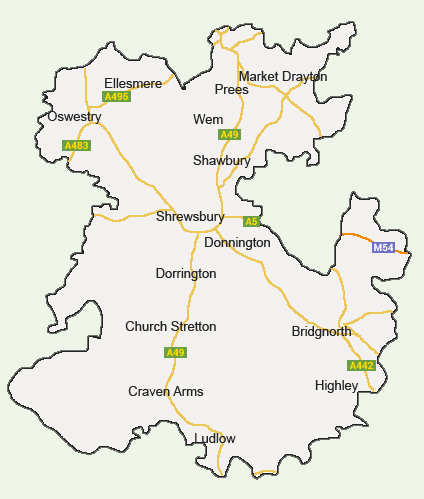
Map of the Shropshire Area
County Council
- Shropshire County Council
- Shirehall Abbey Foregate Shrewsbury Shropshire SY2 6ND
- http://shropshire.gov.uk/
Shropshire
Shropshire's history begins with the Cornovii, a Celtic people who lived in the region during the Iron Age and Roman period. As a result of its long history, the county is home to several historic sites including Shrewsbury Castle, Ludlow Castle, the Shropshire Union Canal and the UNESCO World Heritage Site of Ironbridge Gorge. The county's largest market town is Oswestry, which is also one of the United Kingdom's oldest border settlements. Situated in the West Midlands, Shropshire is bordered by Wales, Cheshire, Staffordshire, Worcestershire, and Herefordshire. A large part of the landlocked county is occupied by the Shropshire Hills, an Area of Outstanding Natural Beauty. The Fenn's, Whixall and Bettisfield Mosses National Nature Reserve, one of the UK's best preserved bogs, is also found in the county.
According to the 2011 Census, Shropshire has a population of 306,129. The county's major settlements include its historic and cultural centre Shrewsbury, as well as Telford, Oswestry, Bridgnorth and Ludlow. With a population density of 136 people per square kilometres (350 per square mile), Shropshire is one of the England's most rural and sparsely populated. The county has a total area of 3,487 square kilometres or 1,346 square miles. Shropshire Council is the unitary authority responsible for local government functions in the county. It was formed in 2009, replacing the former district and borough councils of Bridgnorth, South Shropshire, Shrewsbury and Atcham, Oswestry, and North Shropshire. The new Council also replaced the former Shropshire County Council. Famous former residents include Dr. William Penny Brookes, one of the modern Olympic Movement's founding fathers. Other notable people linked to the county include naturalist Charles Darwin, footballer Joe Hart, classicist Mary Beard, and Robert Clive.
Shropshire's economy was traditionally based on agriculture, although more recently there has been a shift toward service sectors. Most residents are employed in the wholesale and retail sector, with 16.1 percent of people living in Shropshire working in this sector. With a 13.7 percent share, the second largest employer is the health and social work sector. Manufacturing and education are also major employers. Industry is largely centred in Telford, Oswestry, Market Drayton, Whitchurch, and Shrewsbury, which is also a major centre for distribution and warehousing. The 18th century industrial hub of Ironbridge Gorge, the Shropshire Union Canal and linked canal networks, Shrewsbery and Ludlow are also major drivers for the county's tourism sector.
Transport
- Travel Shropshire
- http://www.travelshropshire.co.uk/
Banks and Building Societies
- Branch finder for all Shropshire high street banks listing the address, telephone number, facilities and opening times for each. Also offers savings and investment information, tips and comparisons.
- http://www.theinvestingsite.com/banks/shropshire
Media and Newspapers
- Shropshire Star
- http://www.shropshirestar.com/
Tourism - Official Site
- Shropshire Tourism
- http://www.shropshiretourism.co.uk/
Museum
- Shropshire Museums
- https://www.shropshire.gov.uk/museums
University
- Harper Adams University Newport Shropshire TF10 8NB
- http://www.harper-adams.ac.uk/